


Over 25 million Americans are under threat for damaging winds, large hail, and tornadoes on Saturday.
The long stretch of disruptive severe weather and flash flooding across portions of the central and eastern United States will be shifting east Saturday.
The primary severe weather threats for this area are damaging wind gusts and large hail, with an isolated tornado risk mainly for northern Virginia up to New Hampshire. Flash flooding will also be a risk for those areas and the surrounding areas across the East.


New storms will begin after 1 p.m. ET from the Carolinas up to New York. These storms will make their way east throughout the afternoon into the evening, with some becoming strong enough to produce damaging wind gusts, large hail, and maybe an isolated tornado.
Severe weather activity will quickly wind down just before midnight, but the flash flooding threat will linger around through the overnight with any of the heavier downpours that set up.


The storm system that is responsible for the stormy and wet weather for the eastern U.S. on Saturday is part of an “omega block pattern” where two storm systems are locked in between an area of high pressure.


This pattern creates a sharp contrast in weather conditions across a wide area, and this will certainly be the case for this weekend.
Some of these showers will be heavy enough to produce some isolated flash flooding for parts of the Northeast between Sunday and Tuesday.
On Friday, hail — larger than a tennis ball — was reported near Marquez, Texas, while widespread hail at or larger than quarter-size reported elsewhere from Texas to New York.


In this screen grab from a video, a possible tornado is shown near Killeen, Oklahoma, on May 1, 2025.
Eric Webb/X
There are widespread reports of downed trees and power lines on roadways from Texas to Ohio, along with isolated reports of damage to structures in Texas.
Severe weather and flash flood threat
The western storm system will slowly make its way into the central U.S. by Monday, tapping into moisture from the Gulf and bringing a renewed severe weather and flash flood threat for the region.
For Monday, the severe weather threat is centered over central Texas and includes Fort Stockton, Midland, Lubbock, and Abilene.


The primary risks as of right now look to be large to very-large hail and damaging wind gusts, as well as flash flooding.
These storms will begin to fire up during the early to mid-afternoon as discrete supercellular storms, growing into clusters of storms during the evening.


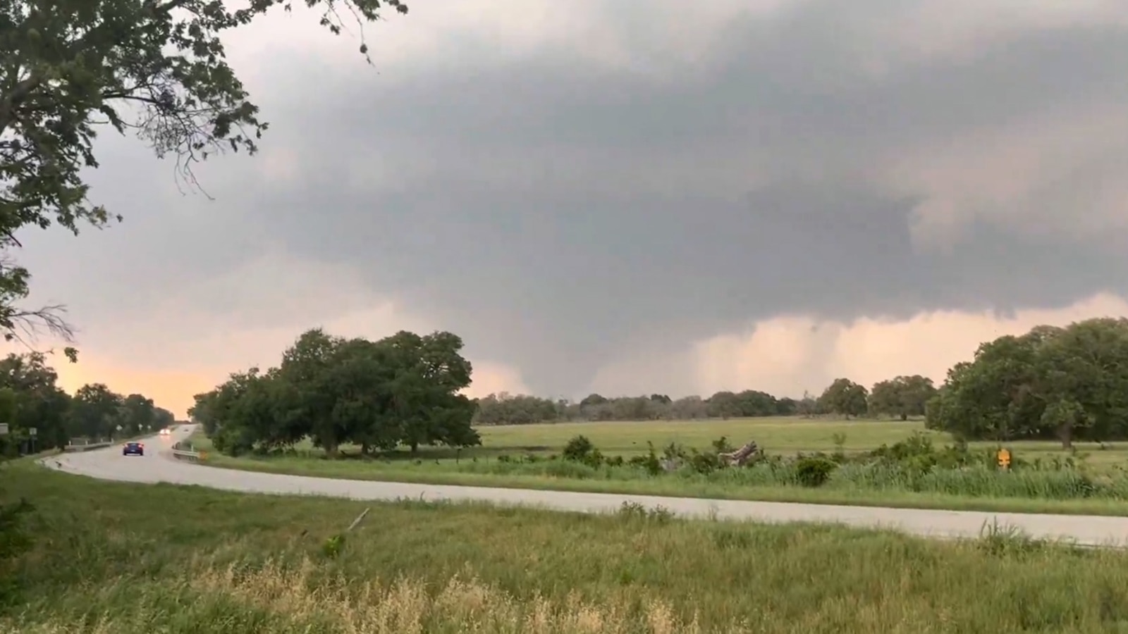
In this screen grab from a video, a possible tornado is shown about 2 miles east of Briggs, Texas, on May 1, 2025.
Logan Martinson
For Tuesday, this storm system will continue to move east, shifting the flash flooding threat to portions of the Deep South and tapping into more moisture for a higher flash flood threat.
The highest flash flood threat for Tuesday (level 3 or 4) is centered over eastern Texas, far southwestern Arkansas and northern Louisiana. This includes Texarkana, Arkansas; Lufkin, Texas; and Shreveport, Louisiana.


Other areas of the Southern Plains and the Deep South are likely to see flash flooding on Tuesday from Oklahoma to Mississippi.
Some of these areas have already seen a lot of rain from the past week, making the ground very saturated. This will make flash flooding easier with any heavy rainfall that happens early next week.
Additionally, rainfall from these storms is still slowly trickling down into the Mississippi River. Because of this, rivers are already elevated and additional rain will likely cause river flooding across the Lower Mississippi River Valley.


