


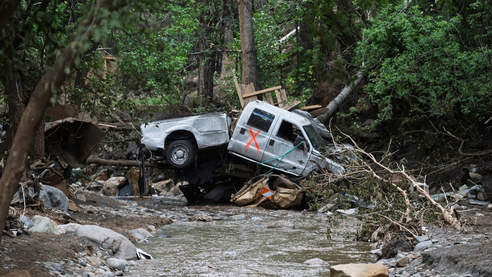
Ruidoso, New Mexico, suffered through its fourth flash flood event in July with reports of swift water rescues, though there has been no confirmation on whether or not there were any casualties.
Ruidoso has been under a “considerable” flash flood warning, with radar estimating that at least 1.5 inches of rain fell across the area.
According to the National Weather Service office in Albuquerque, the Ruidoso Downs Racetrack was overtopped and the Rio Ruidoso at Hollywood crested at 9.4 feet during the latest weather event as additional downpours are possible in the area Thursday into Friday.
Meanwhile, I-95, America’s most populous corridor, is under a flood watch for significant flood potential through Thursday and into the overnight hours as heavy storms could create rainfall rates of up to 3 inches per hour, with the heaviest storms potentially bringing 5 to 8 inches of total rainfall to an isolated area.
All this is happening due to a combination of anomalous moisture, the lingering heat still in the area and above average sea surface temperatures off the coast, fueling this abundant moisture as the upper atmosphere dynamics flowing in from Canada on the north side of the heat dome is being eroded to the South.
The Weather Prediction Center has issued a significant risk for excessive rainfall from Washington, D.C. to Baltimore, Philadelphia and northern New Jersey, as some of these storms could also bring damaging wind and some hail.
Elsewhere, the heat dome that has been plaguing the Midwest, East and South is continuing to truncate toward the Gulf Coast as more than 50 million Americans across 11 states are under heat alerts.

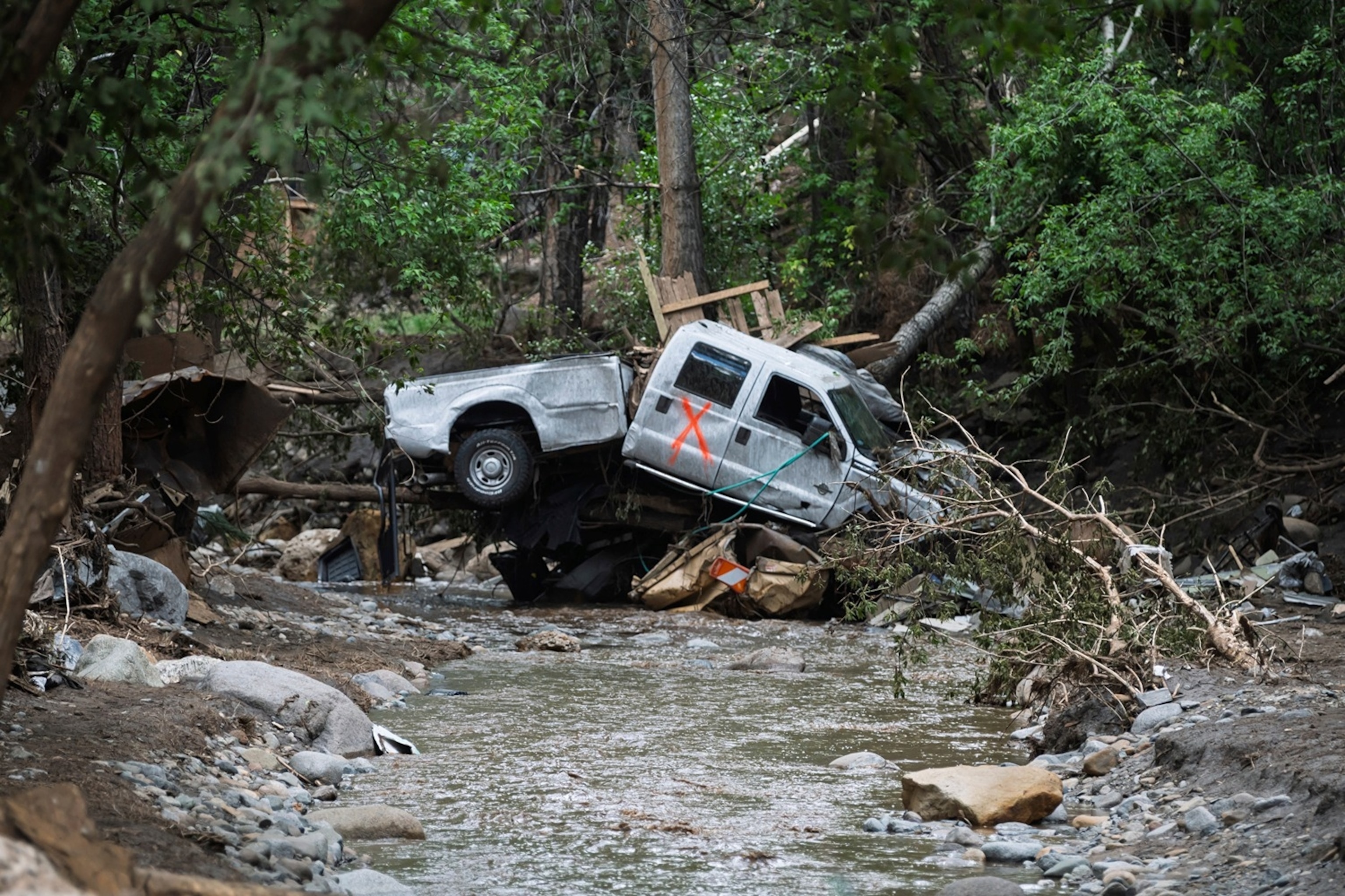
A damaged truck is seen on the banks of the river in Ruidoso, N.M. Wednesday, July 9, 2025, a day after major flooding washed away properties and Rv’s along the Rio Ruidoso Tuesday afternoon.
Roberto E. Rosales/AP
An extreme heat warning is still in effect for the lower Mississippi River Valley on Thursday, where heat indices could reach 110 to 120 degrees from western Tennessee to northern Louisiana, including Mississippi and Arkansas.
Over the weekend, the Southwest will feel extreme heat — with Phoenix and Tucson under an extreme heat warning from Friday to Sunday where temperatures could reach 105 to 114 degrees.
Red flag warnings have also been issued out in the Pacific Northwest as strong thunderstorms could bring lightning and wind gusts up to 60 mph as the lightning could spark new fires and the wind could fuel any new or existing fires.
In Utah, humidity as low as 5% is possible along with gusts up to 35 mph which would allow for new and existing fires to grow rapidly. These fire conditions have allowed the Dragon Bravo Fire on the north side of the Grand Canyon to explode this week, now burning more than 94,000 acres and containment falling to just 4%.
Meanwhile, the entire states of Minnesota, Wisconsin and Michigan are under air quality alerts on Thursday due to wildfire smoke flowing in from Canada where 579 wildfires are raging in and 255 of them are currently labeled as “out of control.”


